Mgarr ix-Xini & Forgotten Pumping Station
Mgarr Ix-Xini is one of the most panoramic sites in Gozo. It’s a very popular spot for swimming, snorkeling and even diving. Abroad it’s probably most famous for being the location of Angelina Jolie and Brad Pitt’s film ‘By the Sea’. But did you know that the valley, known as Wied Hanzira, leading up to Mgarr ir-Xini’s pebble beach is also pretty interesting?
The site is well known spot for rock climbing. The Gozo Climbing Association consideres Mgarr ix-Xini valley as the most appropriate site for rock climbing in Gozo. For me, what makes is even more intriguing is the old pumping station situated in the heart of the valley.
You can spot the top part of the pumping station from the Ta’ Gruwa Road when driving down to Mgarr ir-Xini. There is a hard shoulder where you can leave your car and get this view. The pumping station is not accessible from this side as the stairs are in a state of ruins. To see what’s left of it, you have to go through the valley and that’s exactly what we’re going to do in this photo blog.
Here you can see the stairs and the ramps leading to the pumping station which was used for the transportation of coal into the building.

Mgarr Ix-Xini lies at the south-eastern coast of Gozo. Mgarr Ix-Xini valley is a steep-sided valley running to the fjord-like inlet of Mgarr Ix-Xini. The view of the valley is breathtaking. Being forced to wait (due to restrictions) to explore this amazing place until the end of June I was fearing that there will be no greenery left. Quite the contrary! We were welcomed with abundant vegetation!

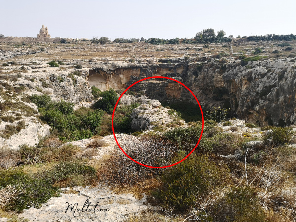
To reach the valley you have to walk towards this projection (marked below). You got to walk to the very end of it until you see steps cut into the stone on your left hand side.


We were a group of eight adventures. Which two of them joined for the first time and one of the newbies asked me: ‘Have you done this trek before?’ and I replied: ‘No, but that’s okey.’ The vast majority of treks I do with my friends I’ve never done before. Yes, I do some research, I know what we’re looking for, but I never really go before to kind of map the location.
I feel that ‘being too prepared’ takes away the adventure. The people I take with me are usually my close friends (and sometimes their friends), but we all like to get lost, and like the feeling of excitement when we find the way again. And sometimes I’m not even the leader. I suggest places, but there are times, when others lead the way or find the way forward.
These are the steps you will be looking for.

Now, very important note. When you go down the steps turn left where the ‘main’ path leads. We went right, thinking that the path was only for the rock climbers, and assuming that to walk through the valley we had to continue to the right. Well, after about 20 minutes of exploring and trying to get through bushes, thorns and God knows what, we were going to go back up and try another route.
Then Elena decided to follow the main path and hooray! There was an opening, which allowed us to cross from one side of the valley to the other. Who would have thought! This is what I call an adventure with a twist! Plus it shows us that we should never assume and always check for ourselves.

Walking though the valley was amazing. The views were stunning, the rocks around us were majestically standing so tall. We didn’t expect to find something so beautiful.


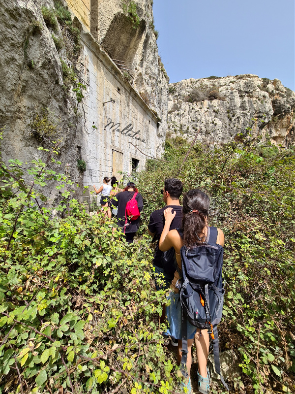
It is not a hard trek, but it’s not exactly easy one either. We didn’t know what to expect, which made it a bit harder, but a lot more exciting. There were many ‘ups’ and ‘down’s, few slips, no falls, yet a lot of thick bushes, nasty thorns on every corner, unexpected branches in the middle of the path and so much more. They truly kept us awake and aware!


I’m not gonna lie, we all felt pretty amazing to be lucky enough to trek this amazing valley. Sometimes we forget about all those beautiful places that we have at our own backyard. So keep your eyes open and take that path you never took before. It always leads somewhere beautiful.


Here it is! The old British coal-powered pumping station with its bridge. The pumping station was erected in 1901 with the purpose to extract ground water. During its lifetime, this majestic structure used to serve almost the whole population of Gozo with fresh table water. Before its construction Gozo was purely dependent on rainwater and water originating from natural springs.
Deep shafts, based on Engineer Osbert Chadwick proposal, were excavated in the valley bed approximately down to sea level. The shafts were connected by a series of mines, or galleries, at water table level. These mines would in-turn direct the flow of water into a pit from where it would be pumped into high level reservoirs. The water would be then distributed by gravity for domestic consumption.

Below I’m sitting on a picturesque bridge. The purpose of it was to carry a cast iron pipeline, which ran across the valley and into an excavated tunnel. This tunnel ran to a reservoir in Nadur, one of the highest hills in Gozo, to transport water into a high-level storage reservoir. There was also a secondary pipeline that supplied water to another reservoir in Ta’ Cenc.
Through out the years the pumping station was updated with a secondary 600.00 gallon steam engine, galleries were extended to be able to extract larger amounts of water. Eventually the boiler plant was replaced by electrically driven pumps. Around the 1950s a five million gallon reservoir was erected at Ta’ Cenc. During the 1960s a new pumping station was erected in Is-Sabbara (Xemxija), which was basically the beginning of the end of Mgarr ix-Xini’s pumping station.

There are two ways to enter the abandoned pumping station. Climbing into a window or fighting your way though bushes and thorns and entering though a door. It is an old building, which is not accessible to the public (obviously), so if you decide to go in, please note it is your own responsibility.

When you enter, we all climbed though the window, you will shortly see the main feature of the old pumping station. This is a few stories deep engine shaft. There is a missing railing so please be very careful. The round opening right behind the engine shaft used to be a spiral staircase that was leading to the lower chambers. The room on the left was a steam-boiler chamber.


This is a view of the spiral staircase that used to lead to the upper levels. We tried to go up, but you can only get to the first floor, from where you can get this view (below). The staircase is damaged and it was unsafe to continue.
Here is yet another great picture of the interior. As I’ve already mentioned the room behind my friends used to be the steam-boiler chamber. Both doors on the left used to lead to a coal bunker.


Now leaving the old pumping station behind and heading towards the Mgarr ix-Xini inlet. It’s been just rough and bumpy footpaths all along, but nothing to stop us from exploring. It’s fair to say that visitors to this valley should be in a relatively fit physique. It could be potentially dangerous for individuals not in an appropriately good shape to make their way though these paths.

The last look back at the over hundred years old pumping station. Its historical significance is highlighted by the fact that it was the first successful attempt to provide a comfortably sufficient supply of water for the inhabitants of Gozo.

The closer we are getting to Mgarr ix-Xini inlet the easier the path is seems to be getting. Which is something everyone wants to hear especially if our hands and feet have been literally butchered with all the bushes, branches and thorns. Well, at the end of the day it’s a proof we had a great trek and they we’re not afraid of a little bit of discomfort.


And here we’re! We made it to the beautiful Mgarr ix-Xini pebble beach to cool down our tired feet. The entire adventure took us 2hrs with multiple photo & exploration stops. Also including a good 20min ‘this is not the way’ mission to figure out, how to actually get though the valley. Now you know, so you could easily complete this trek with a quick peak to the old pumping station under 1h 30mins.

For those interested in the old pumping station you can find more information in the links below:
To have this blog complete, the only thing left to do, is to insert the exact location on GoogleMaps.


