Victoria Lines in Malta
This has been a long-awaiting hike! I’ve been wanting to explore the Victoria Lines for years now. I’ve visited or seen parts of Victoria Lines, but never had the courage to trek alongside this defensive wall. But finally I got lucky and signed up for an organised walk by Malta Treks and Explore. It was quite a challenging walk and the weather wasn’t ideal, but it was a great experience which I would like to share with you together with some brief history of Victoria Lines.

The starting point of the trek was at the Gharghur’s church where we all met last Sunday at 10am. We were a pretty large group, don’t know the exact number, but I would say about a hundred of eager adventurers. 🙂 We started walking downhill towards Madliena carpark, where we took if off road and began following the Victoria Lines.

The Victoria Lines start in Madliena/Bahar ic-Caghar, continue across the width of Malta to the very East of the island and finish at Kuncizzjoni/Fomm ir-Rih. The entire length of this fortified wall is about 12km. The Great Wall of Malta, which is an unofficial name for this wall, runs along a natural geographical barrier known as the Great Fault. Its use for defensive purposes go back to the Knights of Saint John who were the first to systematically utilize the qualities of this natural barrier for military purposes.


With the boss! Gregory is the person behind Malta Treks and Explore. He organises these regular treks to give people like me a change to see Malta from another perspective and explore all the hidden treasures of this island. He also raises funds through these hikes for various charities, so when you participate you not only doing something for yourself, you also helping people in need. Every little helps and he usually asks for €2 donation, which is honestly nothing, but when put together it’s a lot!

The Victoria Lines, originally known as the North West Front, divide the island into two parts. The less developed north and the more heavily populated south. Even thought the Knights were the first to use this natural barrier to their advantage, it was the British who sealed off the northern approaches to the Grand Harbour from the unprotected sandy beaches.
This defensive system was built between 1870 and 1899. The original name, North West Front was changed in 1897 to Victoria Lines to commemorate Queen Victoria’s diamond jubilee. The Victoria Lines consists of four forts: Pembroke, Madliena, Mosta and Bingemma together with number of batteries and an unbroken infantry line, which connects them all together to form a continuous defence system.


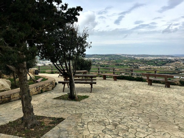
The first quick stop was at the Top of the World, where we got to enjoy some amazing views! There are couple of benches and picnic tables so you can make most out of your visit. We also came across this unusual and very pretty memorial (below).
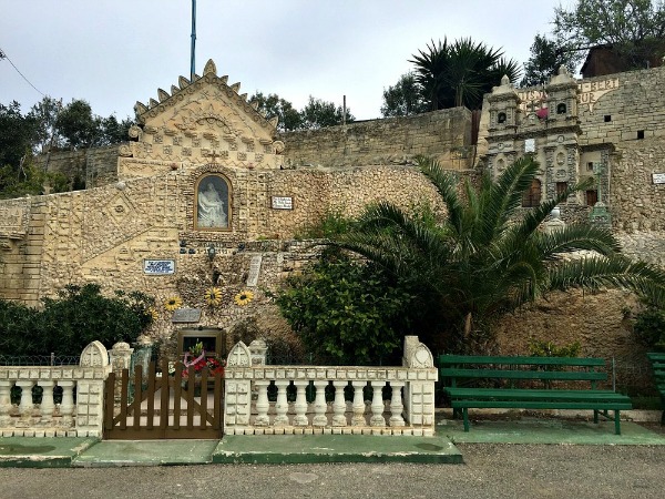

The route was spectacular! Couple kilometres later, we found ourselves in the Valley of Honey in Mosta, which I’ve already visited and wrote a blog about it, so you can check that out for more details. Below you can see the charming chapel of St Paul the Hermit.

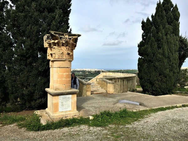
Each time I go out and explore, I always come across something surprising and unexpected. Just look at this column that was erected by students of Targa Gap School for Art and Crafts, which used to form part of the Royal Opera House in Valletta. The Opera House was built in 1862, restored in 1877 after it was severely burnt down in 1873 and in 1942 it was razed to the ground when bombed by the enemy. Today the redesigned ruins of the Royal Opera House are functioning as a performance venue.

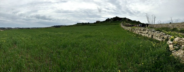
Because the Victoria Lines sit atop some of Malta’s highest grounds, which some of them reach 200 metres above the sea level, when walking along the wall, one can appreciate beautiful views of the entire northern half of the island as well as Comino and Gozo if the visibility is good. Below a couple of fellow explorers are enjoying the gorgeous view of Mosta. I’m sure you can spot the Mosta Dome! 🙂
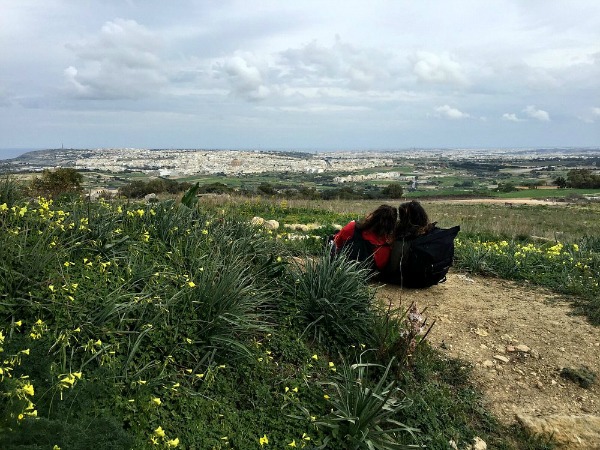

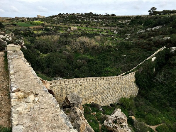
I think this part of Victoria Lines is the nicest and also the easiest when it comes to accessibility. Here is the exact location if you would like to come and explore. There are also couple of caves and old tombs in the area, which you can check out, of course while being mindful of the environment and the historical heritage.


This view of Golden Sands, Manikata and Mgarr is just steps away from the Bingemma Fort, which is the eastern fort of the Victoria Lines. I love Malta at this time of the year as the whole island is just beautifully green!

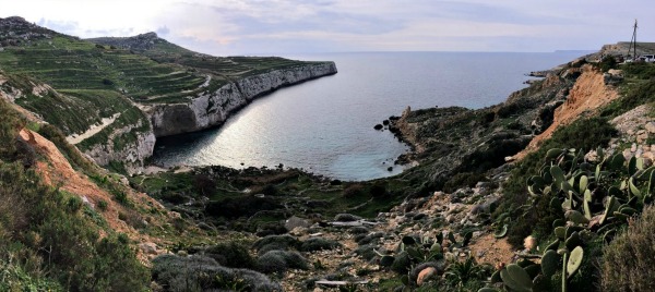
Our last stop, before finishing off our trek in Bahrija, was just here above the Fomm ir-Rih! What a view! This is also another area that I’ve explored in the past and it was great to see it again from different perspective. You can reach this point by car. Actually there was quite a few cars parked in the area and people enjoying the stunning view.
Below is the exact route that we walked last Sunday. I consider myself to be fairly fit, but I was feeling my calves for the next two days! If you wish to walk along the Victoria Lines as well and would prefer to do it in a group, follow Malta Treks and Explore on Facebook as Gregory organises this trek couple of times a year!

Source: Malta Treks & Explore


Can u please tell me when u do the victory lines, as my daughter is coming to Malta and would like to do the walk,
Thank you
Hi Josephine, I’m sorry but I’m just three weeks away from having a baby. 🙂 Check the FB group ‘Malta Treks And Explore’ as Gregory might be organising it in the near future. Hope this helps. 🙂
Hi, small correction. The Victoria lines run for 12km not 20km as you specified 🙂